U.S. Interests Develop Alberta Tar Sands to Boost Commercial Oil Profits « The Canadian Headlines Newspaper

Edited by Peter Tremblay
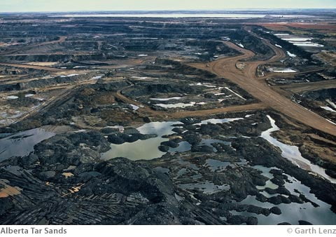
Maps show the U.S. political-military-industrial complex’s interests in destroying Canada’s environment in order to support oil profiteering interest in U.S. “markets”.
These maps show the proposed growth of the tar sands, according to announced and officially proposed mega project components of the gigaproject. Updated from the original maps put out on OilSandsTruth.org two years ago, the following maps were produced with the Indigenous Environmental Network.
Recently while speaking on the Enbridge Gateway Pipeline cutting through the Rocky Mountains and about to enable tar sands oil super tanker traffic on British Columbia’s still mainly pristine Central Coast, Jim Prentice (the Federal Minister for the Environment) said of future proposed developments:
“It is a destination that will see us at the forefront of the industries where we currently excel, oil, natural gas, pipelines, hydro electricity and the orderly development of the oil sands.” Prentice went on to say “We will not aggravate an already weakening economy in the name of environmental progress.”
What does that mean?
In the time since the last pipeline continental maps, one can see new proposed and expanded pipelines cutting this way and that across British Columbia, proposed to splice directly to California as well as reversing several lines to facilitate major tar sands super tanker traffic from Maine to Philadelphia and further along the Atlantic and into the Gulf of Mexico.
Wherever you are in North America there is probably a planned pipeline or refinery “just for you”.
These maps do not include the dozens of refineries in Canada designed or planned to take tar sands mock oil; If the maps listed those it would be so busy as to be unreadable.


